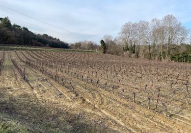
86 km | 102 km-effort
Trip 2022-03-11
Alain Derrives
Gebruiker
Lengte
37 km
Max. hoogte
590 m
Positief hoogteverschil
999 m
Km-Effort
51 km
Min. hoogte
313 m
Negatief hoogteverschil
998 m
Boucle
Ja
Datum van aanmaak :
2022-03-11 17:34:53.684
Laatste wijziging :
2022-03-11 18:03:45.403
3h15
Moeilijkheid : Zeer moeilijk
Gratisgps-wandelapplicatie
Over ons
Tocht Mountainbike van 37 km beschikbaar op Provence-Alpes-Côte d'Azur, Vaucluse, La Bastidonne. Deze tocht wordt voorgesteld door Alain Derrives.
Plaatsbepaling
Land:
France
Regio :
Provence-Alpes-Côte d'Azur
Departement/Provincie :
Vaucluse
Gemeente :
La Bastidonne
Locatie:
Unknown
Vertrek:(Dec)
Vertrek:(UTM)
707107 ; 4841449 (31T) N.
Opmerkingen
Wandeltochten in de omgeving
Le Pays d'Aigues à vélo
Fiets
Medium
(2)
La Tour-d'Aigues,
Provence-Alpes-Côte d'Azur,
Vaucluse,
France
5h 49min
Ja
La Bastidonne 2015
Mountainbike
Medium
(1)
La Bastidonne,
Provence-Alpes-Côte d'Azur,
Vaucluse,
France
24 km | 28 km-effort
1h 51min
Ja
PF-La Tour d'Aigues - La Bastidonne - La Chapelle St Julien
Stappen
Medium
La Tour-d'Aigues,
Provence-Alpes-Côte d'Azur,
Vaucluse,
France
14,7 km | 18,8 km-effort
4h 45min
Ja
GB tour du lac de Peyrolles
Stappen
Gemakkelijk
(1)
Peyrolles-en-Provence,
Provence-Alpes-Côte d'Azur,
Bouches-du-Rhône,
France
3,8 km | 4,2 km-effort
1h 23min
Neen
Sunday Templars
Stappen
Gemakkelijk
(1)
Grambois,
Provence-Alpes-Côte d'Azur,
Vaucluse,
France
11,8 km | 16 km-effort
59min
Ja
Vignes du Château de la Dorgonne
Stappen
Heel gemakkelijk
La Tour-d'Aigues,
Provence-Alpes-Côte d'Azur,
Vaucluse,
France
6,3 km | 8,1 km-effort
1h 32min
Ja
La tour d'Aigues
Stappen
Gemakkelijk
(1)
La Tour-d'Aigues,
Provence-Alpes-Côte d'Azur,
Vaucluse,
France
14,4 km | 18,2 km-effort
3h 59min
Ja
La Tour Cucuron
Fiets
Gemakkelijk
(1)
La Tour-d'Aigues,
Provence-Alpes-Côte d'Azur,
Vaucluse,
France
27 km | 32 km-effort
1h 50min
Ja
En passant par la montagne
Fiets
Gemakkelijk
(1)
La Tour-d'Aigues,
Provence-Alpes-Côte d'Azur,
Vaucluse,
France
18,6 km | 23 km-effort
1h 40min
Ja